GithubHelp home page GithubHelp logo

visugps3's Introduction

VisuGps3

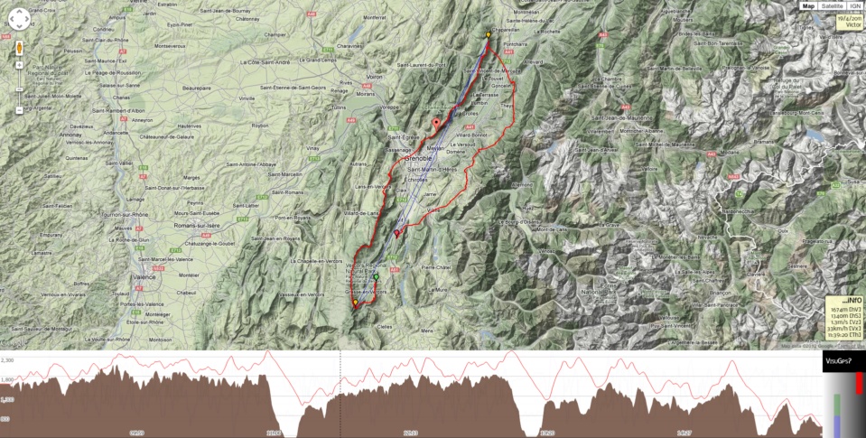
Display GPS tracks on top of Google maps.

VisuGps3

Powered by:

This is the next version of VisuGps, one of my first web project. It has been rewritten to leverage the latest JS API form Google as the maps API v2 will be deprecated in 2013.

Supported features

  • Display a single or multiple tracks on top of a map,
  • Display charts for elevation, horizontal & vertical speed,
  • The track can be viewed in 3D
    • on platforms where the GE plugin is supported,
    • without any plugin if your browser support WebGL thanks to DoArama - based on Cesium
  • Display markers for routes,
  • Measure distances with the path plugin,
  • Display restricted airspaces,
  • Display skyways thanks to Michael von Känel,
  • Switch to full screen mode,
  • Topographic maps:

Roadmap

future versions

  • use GeoJSON

Contributors

Credits

visugps3's People

Contributors

twpayne avatar vicb avatar

Stargazers

 avatar  avatar  avatar  avatar  avatar  avatar  avatar  avatar  avatar  avatar  avatar  avatar  avatar  avatar  avatar  avatar  avatar  avatar  avatar  avatar  avatar  avatar  avatar  avatar  avatar  avatar  avatar  avatar  avatar  avatar  avatar  avatar  avatar  avatar  avatar  avatar

Watchers

 avatar  avatar  avatar  avatar  avatar  avatar  avatar  avatar  avatar

visugps3's Issues

make fails on ubuntu 16.04

I try to install VisuGps3 on my personal server and unfortunately make fails on ubuntu 16.04:

$ make dist/vgps3.js
make: ***  Aucune règle pour fabriquer la cible « build/make.js », nécessaire pour « dist/vgps3.js ». Arrêt.

How to install VisuGps3 ?

Hi,
I'm trying to add VisuGps on my website, but I have some problems.
With the vgps3.js file from the repository, the console logs that 'goog is not defined' and 'vgps3 is not defined'. What can I do ?
Can you also say me where the GPS file is it loaded ?

Thanks a lot for your anwser and for this plugin :)

missing dependency : six

While trying to make lint, I get an ImportError: No module named six.

Si I added the missing dependency:

pip install six

It does now go further.

make fails on ubuntu 17.10

I try to install VisuGps3 on my personal server and unfortunately make fails on ubuntu 17.10:

$ make dist/vgps3.js
make: ***  Aucune règle pour fabriquer la cible « build/make.js », nécessaire pour « dist/vgps3.js ». Arrêt.

And I do have plovr-81ed862.jar installed in VisuGps3 directory.

iframe intégration

When VisuGps is integrated in a iframe and not visible on screen, the page is scrolled to make Visugps visible.

It should not happen. This is due to the popup used by the loadmask.

DoArama & Google Earth

As doarama is not supported for IE & google earth only supported on win + macos:

  • Remove the GE map type,
  • The 3D entry point will be the camera icon,
  • 3D backend will be doarama for all browsers excepting IE where GE plugin will be used

Unable to open IGC via an url

Hello,
Visu the URL of your track doesn't work !
for example,
http://www.victorb.fr/visugps/visugps.html?track=http://labandedebande.free.fr/trace-vol/mont-blanc-chamonix.igc
return 2 Javascrit errors :
1- visugps.html?track=http://labandedebande.free.fr/trace-vol/mont-blanc-chamonix.igc:43 unregistered site
(anonymous) @ visugps.html?track=http://labandedebande.free.fr/trace-vol/mont-blanc-chamonix.igc:43
2- js?v=3&libraries=geometry&key=no-key&callback=google.loader.callbacks.maps:70 Google Maps JavaScript API error: InvalidKeyMapError
https://developers.google.com/maps/documentation/javascript/error-messages#invalid-key-map-error
Many Thanks
Nicolas

In chart, display hours according to browser timezone and daylight saving

It would be nice to display time according to current browser / OS settings so that users - especially those not used with the tool - are not induced in error.
For instance:

  • I flew yesterday at the end of the day from 17:54 UTC to 19:27 UTC.
  • My computer is in french timezone with daylight saving wich means 17H UTC = 19H french time (as of today july 6th)
  • Current chart shows values "18h10, 18h25, 18h41, 18h56, 19h11"
  • It would be nice to display : "20h10(utc+2), 20h25(utc+2), 20h41(utc+2), 20h56(utc+2), 21h11(utc+2)"
    [or maybe display (utc+2) only in a chart corner]

Another example of software which does date formatting according to browser is Kibana (ElasticSearch viewer). See dateFormat:tz setting described at https://www.elastic.co/guide/en/kibana/5.4/advanced-options.html :

The timezone that Kibana uses. The default value of Browser uses the timezone detected by the browser.


I suppose its do-able by using something like that:
-(new Date()).getTimezoneOffset()/60
around https://github.com/vicb/VisuGps3/blob/master/src/vgps3/plugins/chart/chart.js#L411

[Also need to update info panel with "[Th]" label]

I suppose we should be careful not to surprise users with such change, either by :

  • making it clear date is in UTC+/-x
  • ability to choose "use browser timezone" or use the term "UTC" somewhere

What do you think? Has it already been discussed?

Add an option for displaying the track enveloppe

For track shapes that are very different from a triangle, I'd like to know what's the geometric enveloppe of my track. (The enveloppe is like a giant rubber band wrapped around the track.)
Would it be possible to add an option for displaying the enveloppe and its length?
For example, a small button with a lasso in it, below the other green buttons in the top-right corner of the map, would show/hide the enveloppe on the map, and a message box somewhere with the enveloppe length and its opening lengths. (The opening length is the distance between the start and end waypoints.)

Recommend Projects

  • React photo React

    A declarative, efficient, and flexible JavaScript library for building user interfaces.

  • Vue.js photo Vue.js

    🖖 Vue.js is a progressive, incrementally-adoptable JavaScript framework for building UI on the web.

  • Typescript photo Typescript

    TypeScript is a superset of JavaScript that compiles to clean JavaScript output.

  • TensorFlow photo TensorFlow

    An Open Source Machine Learning Framework for Everyone

  • Django photo Django

    The Web framework for perfectionists with deadlines.

  • D3 photo D3

    Bring data to life with SVG, Canvas and HTML. 📊📈🎉

Recommend Topics

  • javascript

    JavaScript (JS) is a lightweight interpreted programming language with first-class functions.

  • web

    Some thing interesting about web. New door for the world.

  • server

    A server is a program made to process requests and deliver data to clients.

  • Machine learning

    Machine learning is a way of modeling and interpreting data that allows a piece of software to respond intelligently.

  • Game

    Some thing interesting about game, make everyone happy.

Recommend Org

  • Facebook photo Facebook

    We are working to build community through open source technology. NB: members must have two-factor auth.

  • Microsoft photo Microsoft

    Open source projects and samples from Microsoft.

  • Google photo Google

    Google ❤️ Open Source for everyone.

  • D3 photo D3

    Data-Driven Documents codes.