![]()
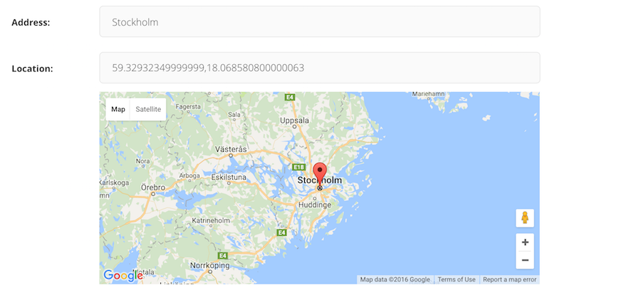
Wagtail-Geo-Widget is the complete map solution for your Wagtail site.
- Supports Google Maps or any tile provider supported by Leaflet (such as Open Street Map or Mapbox)
- Real spatial support (with GeoDjango and PointField)
- Storing coordinates as strings (for no-GeoDjango setups)
- StreamField integration
- Searching with geocoding (supports Google Geocoding, Nominatim and Mapbox)
- Inline panel support
- Optional address search field
- Language support
- Getting started with Google Maps
- Getting started with Leaflet
- Settings
- Adding the widget to a Page
- Integrating with GeoDjango
- Adding to a StreamField
- Supported Geocoders
- FAQ
If you have ideas for improvement, please share your thoughts through an issue.
- Issue Tracker: https://github.com/Frojd/wagtail-geo-widget/issues
- Source Code: https://github.com/Frojd/wagtail-geo-widget
- Contribution documentation
We also welcome Pull Requests (PR). Please note that this project uses git-flow so please use the develop branch when creating PR's.
If you believe you have found a security issue with any of our projects please email us at [email protected].
Wagtail-Geo-Widget is released under the MIT License.
![dependabot-preview[bot] avatar](https://avatars.githubusercontent.com/in/2141?v=4 "dependabot-preview[bot]")
![dependabot[bot] avatar](https://avatars.githubusercontent.com/in/29110?v=4 "dependabot[bot]")