Currently the colors/rendering of secondary and tertiary highways seem to me to be the wrong way around in terms of "significance", This image
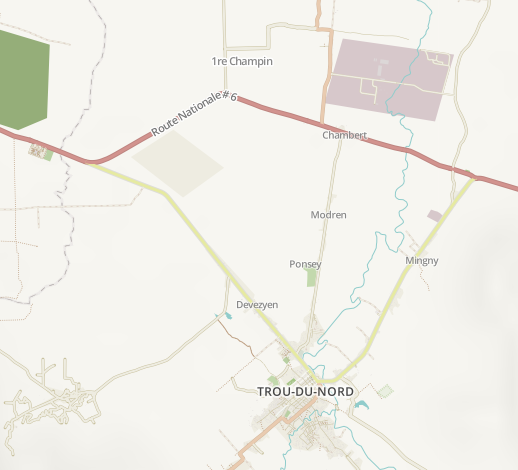
implies to me that the secondary road (old -- and actually still officially -- primary) road to Trou-du-Nord would be less significant than the tertiary roads to Caracol and south of TdN.
Now, I haven't yet fully figured out how the surface/smoothness(/practicability?) tags impact the rendering so I might be missing something (and this might be also a data issue). .. But it's clear that those roads don't currently render in a way that would reflect ground reality.
Ok. Looking a bit at the data it seems that the surface tag is taken in consideration and the default value is to show ways w/out surface tag as strong (same as paved).
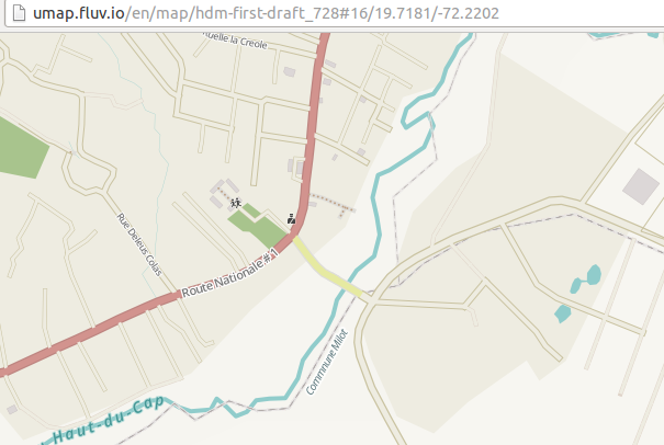
The secondary/tertiary roads should still be flipped the other way around, imo.
FOR UNCLASSIFIED:
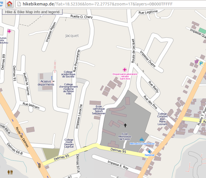
I'd very much like to see some level of emphasis for unclassified vs. residential as it is the lowest level of the interconnecting road network (in urban areas). Now I know of only HikeBikeMap.de that would show the difference between residential/unclassified. And that's a pity because it doesn't encourage to tag properly -- nor to even understand that there is difference.
Examples (compare rue des Pins = unclssified and clear through road vs. rue Bailly = residential non-through road):

and then ... hmm. . the HOT Style actually shows the difference between unclassified and residential...
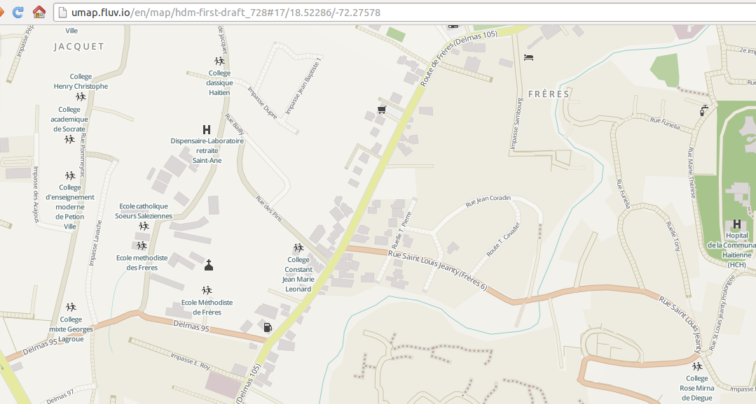
... but only if they are both surface=paved...
See rue Marie Therese next to HCH hospital in the right corner of the area (http://umap.fluv.io/en/map/hdm-first-draft_728#17/18.52375/-72.27561). That is an unpaved heavily used for through traffic unclassified road. .. HMm. I\m concluding that when it's unclassified it should show always more prominently than residential.
Thoughts?