events's Introduction
events's People
Contributors

Watchers

events's Issues
OSM x GM "Glitch"
I just read Side-by-side images expose a glitch in Google’s maps from Quartz that highlights some shortcomings of Google Maps (GM), and calls them "glitches". I find it amusing because I often here the same assertions against OSM.
Immediately, what came to mind was how the OSM community is faring in these areas:
Morro dos Prazeres
© 2017 BBBike.org & Geofabrik GmbH - map data (©) OpenStreetMap.org contributors

Makoko, Lagos
© 2017 BBBike.org & Geofabrik GmbH - map data (©) OpenStreetMap.org contributors

Nomgon, Ömnögovi Province, Gobi
© 2017 BBBike.org & Geofabrik GmbH - map data (©) OpenStreetMap.org contributors

Fitri, Chad
© 2017 BBBike.org & Geofabrik GmbH - map data (©) OpenStreetMap.org contributors

So, do is OSM, at large, doing any better than GM, right now? No, not really. Not yet.
We all know that it's the local community that makes the real difference, and it's unlikely there's any active ones there, hence the very bare coverage.
In the long run, as soon as these areas do get better data, the Open nature of the data license provided by OSM makes it superior to what GM can offer.
While the article decries about the lack of data, and these communities are "invisible" from GM. The writer may not have recognized why OSM is the platform of choice by many humanitarian organizations.
When communities recognize the need to become "visible" by being depicted in public maps, to have a voice in governance, they are very welcome to do so in OSM. The community mapping efforts of the [Kibera project] (https://mapkibera.org) in Nairobi, Kenya; its empowerment of the community that's called the largest slum in Africa proves that. And that is happening all over the world. External actors could introduce OSM mapping, but it can only be sustained by an active community of contributors and end-users.

Kibera - from blank spot, to one of the most densest mapped neighbourhoods in OSM today.
© 2017 © OpenStreetMap.org contributors
As a corporation, GM will always have an underlying (commercial) reason for doing things. In OSM, I'd like to think we map because we can.
Davao City Fire District (BFP Davao City)
Pre-event Tasks:
- write letter of introduction and data request
- meet with the local officers and administrators
- schedule a mapa-thon / map jam. See https://ti.to/mapamore/kadayawan2017
- invite local community and other stake holders: OSM, DDRMO, volunteer fire companies
- prepare a micro-tasking event
Post-event Tasks:
- send thank you email to collaborators
- issue digital credentials via GeoBadges to participants
- do a write-up for the activity
San Juan City Photo-mapping
General Santos City Fire Office (BFP GenSan)
To do:
- write letter of invitation to participate, [email protected].
- [ ] invite local community: OSM, DDRMO, volunteer fire companies
- [ ] schedule mapa-thon/workshop - map jam with the local fire deparment
Mapping with OpenStreetMap in Davao City
- coordinate with host about topic coverage
- conduct workshop
- write-up
2018-09-16 Mapathon for Ompong
Community response to typhoon Ompong, mapping areas in northern Luzon affected by the typhoon.
- Host: Red Cross, c/o Red Cross VCAD project
- Tasking Manager tasks for Ompong
2018-09-23 OpenStreetMap Mapathon 3 - #ompongPH
Community response to typhoon Ompong, mapping areas in northern Luzon affected by the typhoon.
- Tasking Manager tasks for Ompong
- Host: Red Cross, c/o Red Cross VCAD project
- Sponsor: Kaart
NCR Fire Districts
NCR Districts
- - Fire District I - Manila Fire District
- - Fire District II
- - Caloocan
- - Malabon
- - Navotas
- - Valenzuela
- - Fire District III
- - Makati
- - Pasay
- - Parañaque
- - Las Piñas
- - Muntinlupa
- - Fire District IV
- -Mandaluyong
- -Marikina
- -Pasig
- -Pateros
- -San Juan City
- -Taguig
- -Fire Distrive V - Quezon Fire District (Quezon City)
City Mapa-thon - (San) Juan more time
RSVP and registration: https://ti.to/mapamore/juan-more-time
Objective: Completing pending and incomplete DRR facilities, basic data for barangays in San Juan city.
See: #5
Photo-mapping with Bunny Soriano, and Marikina biking group.
- AOI: Marikina
- finalize dates, participants.
- write-up
City of Manila
Completed in 2016
MapaTime! October

Theme: MapaBabae - Mapping social facilities and institutions that support VAWfreePH
Co-ordinator: Nalie Vicario (GeoLadies)
Photos: https://wiki.openstreetmap.org/wiki/Category:MapaTime
Lightning talk presenters:
- OpenStreetMap is
OSMawesome! by Erwin - 2018 18-day Campaign to End VAWC by Liane Rivas (PCW)
- DSWD Programs and Services on VAWC by Rosemy Taburnal (DSWD)
- DSWD MapViewer and Updates by Mac Labrador (DSWD)
- Mental Health aWHEREness PH by Andi Tabinas (mhamaph.com)
Open Source Mapping Workshop using OpenStreetmap with Tambayan Center, Davao
- plan workshop content with Organizers
- building training team
- conduct workshop
- complete other deliverables
- do post-event write-up c/o @jenjerenjen
[mapa-talk] Kick-off event
Reference: https://github.com/orgs/mapamore/projects/1#card-3121079
What: Mapa-talk
Who: PUP San Juan community, Public
Where: PUP San Juan Campus
When: 2016-10-03, 09:00-12:00
Outline
| Topic / Subject Area | Resource Person | Affiliation |
|---|---|---|
| Community: SFD in PH | Mac Yanto | Computer Professionals' Union |
| Information Security | Drexx Lagui | Laggui and Associates, Inc. |
| Multimedia | Arielle Cruz | |
| Community: OpenStreetMap | Rally de Leon | OSMph |
| Photo-mapping: Street-level Imagery | Eduardo Neerhut | Mapillary |
| Project: Healthsites.io | Nate Smith | HOT; OpenAerialMap |
Geoweek event at University of San Carlos, Cebu City
Venue: University of San Carlos, Talamban Campus, Cebu City
Sign-up: https://ti.to/mapamore/osm-geoweek-2017-cebu/
Event type: Mapa-talk
Points of contact:
- Rose Lappad (Head, Cebuano Studies Center)
- Laila Labajo (Chairperson, department of Anthropology, Sociology and History)
- Devra Rae Ouano (Instructor, GIS)
To do:
- discuss activity feasibility, and possible dates
- create sign-up page, post event in OSM calendar, share with SNS
- coordinate event details with PoC
- facilitate the event
- post diary entry to OSM
- issue Geobadges to participants
- send thank you note to collaborators
Conceptualization meeting with collaborators: PUPSJC + DRRMO
Introductions by Jimmy G to CDRRMO contacts.
- Preface: FOSS and OSM
- On-going collaboration with PUPSJC
- Possibilities of collaboration with DRRMO - what are your needs?
Maptime! Manila, 26th July 2018
Maptime! Manila hosted by CWTS++ program in PUP San Juan, 10:45-13:15
Presenters
- Jen Alconis: Mapping with the gender lens
- RK Aranas: City Street Orientation & Intro to Maptime! Diliman
- Rally de Leon: Kapit-bahayan
MapaTime! 2019 January -
Marikina Field Mapping @ Lilac Street
The LRT2 light-rail line that runs from Recto to Santolan in Marikina allows riders to bring their folding bikes (only in the last coach, and only up to 4 folded bikes per train)

Yesterday's Marikina City Mapping Party is the first field mapping activity organized by MapaTime! - and our first activity for the 2019. Also, the last the local OpenStreetMap community organized such an activity was back in 2016. This time, we also encouraged people to bring their bikes (or skateboards, and kick scooters)
The early Sunday ride was pleasant, and the coaches barely full

And because I missed the earlier train, I was late for the 06:30 breakfast briefing. Our early birds: Gillian, Ruby, Rap - all first timers, we're already asking in the Telegram channel about where everyone is. They got Mapillary schwags (tees, phone holders) for coming in early!
Breakfast briefing on OpenStreetMap and FieldPapers

As soon as we had enough people, I gave a short introduction to OpenStreetMap and guidelines on how (easy it is) to use FieldPapers. We then had breakfast, and gave the stragglers a few more minutes.
FieldPapers Atlas of the area of interest

All-in-all, we had 14 people who showed up. Some were students (the youngest participant is a university froshie), a number of people work for government agencies who are interested in utilizing OSM, and three others who are from the private sector, checking out how OSM might be used in their business.
The team who dubbed themselves as "Walkerz" were assigned to work on grids along two major roads using FieldPapers.
Team Walkerz photos. © 2019. Arnalie Vicario.

Meanwhile, the cyclists, "Team Padyak" divided the surrounding areas into 4 large quadrants and collected street-level imagery using Smartphones + Mapillary or Action Cameras.
A very brief briefing for Team Padyak

(Disclosure: Actually, that's "all cyclists except for one" - I went home, excited to upload the collection, only to find a memory card with three useless photos 🙄 As penance for my sins, I woke up early today and went around my city to fill-in the street-level photo blanks. 🚴♂️ )
Team Padyak - the cycling team collected photos using Mapillary (and some Walkerz photo-bombing us. 🤣

And off we went. After about 1.5 hours, we met up in another location for lunch, and shared about individual experiences, including tips about how they went about their assignments.
Bunny and Ruby, sharing experiences and showing some of the photos they collected on their Mapillary app.

And we continued our conversations over lunch, discussed future plans, and generally had fun for this month's MapaTime!
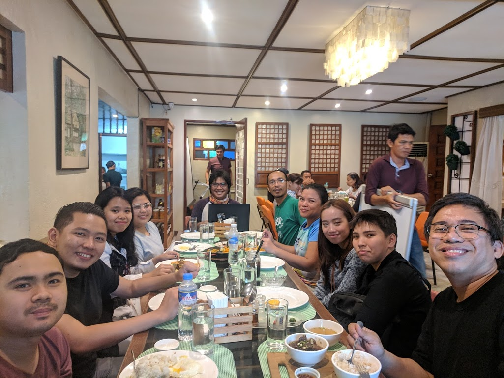
The following group photo was taken after the field work, and everyone still looks fresh !
NCR Fire Districts
See: #10
Kick-off event
ref: #1
MapaTime! November

Theme: Geography Awareness Week
SIgn-up page: https://ti.to/mapamore/mapatime
Co-ordinator: RK Aranas
Gallery: https://wiki.openstreetmap.org/wiki/Category:MapaTime
Lightning talks
San Juan, NCR
done with San Juan City
Peasant Mapathon

Where: NCCP, 877 EDSA, Quezon City
When: 29th Sep 2018, 15:00-20:00
Team:
OpenStreetMap training for PUPSJC volunteers
What: Training
Who: PUP San Juan community
Where: PUP San Juan Campus
When: 2016-11-28 - 2017-02-13
CWTS++ Pilot, 2018
Collaborator: PUP San Juan
Term: AY 2018, Term 1
Participants: volunteer first year students from PUPSJ-CCIS, in lieu of regular NSTP-CWTS.
Maptime! Manila, 27th Sep 2018
Maptime! Manila hosted by CWTS++ program in PUP San Juan, 10:45-13:15
Presenters
- I.P. Rebong : Intro to CWTS++
- E. Sangjo & S.A. Esteves : Motivations for Mapping
- Bunny Soriano: Application of UAV in Spatial Mapping of Urban Forest Cover
- Mikko Tamura: OpenStreetMap and the Philippine Red Cross
DRR Mapa-thon for San Juan
Workshop - Community Mapping with the Elderly
Community Partner: MiAmore House of Care
Venue Partner: YouthMappers chapter, FEU Institute of Technology
Sign-up: https://ti.to/mapamore/mapping-with-the-elderly
Event type: Workshop, basic
Facilitator: Rally de Leon
Points of contact:
- Bing Racadio (Founder, MiAmore House of Care)
- Pierre Edwin See Tiong (FEU YouthMappers)
To do:
- discuss activity feasibility, and possible dates
- create sign-up page, post event in OSM calendar, share with SNS
- coordinate event details with working partners
- facilitate the event
- post diary entry to OSM
- issue Geobadges to participants
Recommend Projects
-
 React
React
A declarative, efficient, and flexible JavaScript library for building user interfaces.
-
Vue.js
🖖 Vue.js is a progressive, incrementally-adoptable JavaScript framework for building UI on the web.
-
 Typescript
TypeScript is a superset of JavaScript that compiles to clean JavaScript output.
-
TensorFlow
An Open Source Machine Learning Framework for Everyone
-
Django
The Web framework for perfectionists with deadlines.
-
 Laravel
A PHP framework for web artisans
-
D3
Bring data to life with SVG, Canvas and HTML. 📊📈🎉
-
Recommend Topics
-
javascript
JavaScript (JS) is a lightweight interpreted programming language with first-class functions.
-
web
Some thing interesting about web. New door for the world.
-
server
A server is a program made to process requests and deliver data to clients.
-
Machine learning
Machine learning is a way of modeling and interpreting data that allows a piece of software to respond intelligently.
-
Visualization
Some thing interesting about visualization, use data art
-
Game
Some thing interesting about game, make everyone happy.
Recommend Org
-
Facebook
We are working to build community through open source technology. NB: members must have two-factor auth.
-
Microsoft
Open source projects and samples from Microsoft.
-
Google
Google ❤️ Open Source for everyone.
-
Alibaba
Alibaba Open Source for everyone
-
D3
Data-Driven Documents codes.
-
Tencent
China tencent open source team.