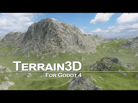
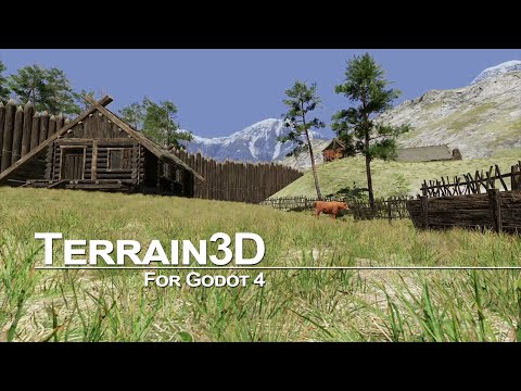
A high performance, editable terrain system for Godot 4.
- Written in C++ as a GDExtension plugin, which works with official engine builds
- Can be accessed by GDScript, C#, and any language Godot supports
- Geometric Clipmap Mesh Terrain, as used in The Witcher 3. See System Architecture
- Up to 16k x 16k in 1k regions (imagine multiple islands without paying for 16k^2 vram)
- Up to 10 Levels of Detail (LODs)
- Up to 32 texture sets using albedo, normal, roughness, height
- Sculpting, holes, texture painting, texture detiling, painting colors and wetness
- Supports importing heightmaps from HTerrain, WorldMachine, Unity, Unreal and any tool that can export a heightmap (raw/r16/exr/+). See importing data
See Project Status for details.
-
Read the Installation instructions, and the rest of the documentation.
-
For support, read Getting Help or join our Discord server.
-
Watch the tutorial videos:
Installation, Setup, Basic Usage
Texture Painting, Holes, Navigation, Advanced Usage
Developed for the Godot community by:
| Cory Petkovsek, Tokisan Games | |
| Roope Palmroos, Outobugi Games |
And other contributors displayed on the right of the github page and in AUTHORS.md.
Geometry clipmap mesh code created by Mike J. Savage. Blog and repository code released under the MIT license per email communication with Mike.
Please see CONTRIBUTING.md if you would like to help make Terrain3D the best terrain system for Godot.
This plugin has been released under the MIT License.