nrcan / gsc-field-application Goto Github PK
View Code? Open in Web Editor NEWGeological Survey Canada on site data collection for geologists.
License: Other
Geological Survey Canada on site data collection for geologists.
License: Other
Do anything
Lorsque je load une bd sql lite pour visualiser dans un projet déja existant, impossible de la tourner à "off" dans le menu "Layers". Je dois l'effacer pour qu'elle disparaisse.
Will need these edits in the schema so the new location dialog works better for manual data entry, see #7.
Do some test whether it could be possible to work with EntityFramework. it would prevent us from hardcoding the tables and fields names inside classes.
Found a blog that could help with this task: https://erazerbrecht.wordpress.com/2015/06/11/sqlite-entityframework-6-tutorial/
http://stackoverflow.com/questions/33169352/how-to-use-sqlite-with-entity-framework-6-on-uwp
Found something on Microsoft website: https://blogs.windows.com/buildingapps/2016/05/03/data-access-in-universal-windows-platform-uwp-apps/#EX9Pl5LQqem7FHQE.97
The problem is, they say install EntityFramework.Sqlite from nuget and to get it as a pre-release version, even with the option checked, the package can't be found anywhere...
https://gsc-datacollection.visualstudio.com/Mockup1/_workitems/edit/90
Since there is still no library in UWP for Spatial Lite, so I tried different avenues.
In QGIS, it's pretty easy to convert our Sqlite database into a spatialite one.
Need to install Spatialite GUI pluggin (QSpatialite)
Connect to the database and the GUI will detect it isn't a spatialite db and will add the proper tables and functions to it.
In QGIS, it's also pretty easy to convert F_LOCATION into a point feature
https://pvanb.wordpress.com/2012/07/30/from-xy-table-to-spatial-table-in-spatialite/
From the same above link, importing lat/long coordinates into the geometry field is quick.
Unfortunately, the added geometry field is linked to some triggers and functions that aren't activated once in DataCollector app, giving an error when trying to add a record. I was planning on adding a record then updating the geometry field with a sql query, but the first step doesn't work. From what I've read, we need to activate spatial lite extension in order to use the functions, when not used in QGIS or other made up spatial lite GUI.
Once all of this is done, it's quite quick to create some spatial views from location and make visibile sample, earthmats and other stations on a map. Again all in QGIS. The good thing is, when created those spatial views can also be viewable in Arc.
For field trips, I guess we could write some python scripts for QGIS that could batch recreate those spatial views and convert F_LOCATION each time a user needs it.
Spatial views:
https://www.gaia-gis.it/gaia-sins/spatialite-cookbook/html/sp-view.html
Since we are now dealing with a spatialite database with the python tools, I tested again and also since we are renaming features differently against table, it works well in the application. Even the views that are created for earthmat, sample and structures gets updates dynamically. If we could find a way of having spatial views that could be great.
Embedding the spatialite version with all preset feature could impact the python tools by removing 2 of them.
Reported by @AnnickMorin , on behalf of Michel.
Writing "iron" in the search box doesn't show anything. We should be able to see "sedimentary - ironstone ; banded iron formation ..."
I did a quick test and it is a bug...
Suggested by Stephen
We currently have the ability to go from a selected station on the map, to the corresponding entry on the field note page. Would there be any use in having the opposite as well - select a station on the field note page and go to that location on the map page?
Calculated ID are all made shorter. I don't remember why I did this the first time. I don't think it was a field length restriction. Maybe I was trying to get shorter ID to get people less scared about them...anyway it doesn't make sense anymore.
When the user sets up the App with their name, GSC officer code, project type, they can also set their naming scheme for StationID, EarthMatID, SampleID.
One option is to select from a ComboBox preset conventions
StationID, EarthMatID, Sample/MeasurementID:
Will need to get feedback on what formats make sense for geologists and all other stakeholders involved, including the Collections group and SMS that may be impacted.
Kathleen and Pierre told me to have at least the YY and GSC codes, that's a must. The proposed calculation are fine with that rule.
This could be added to the setting page. By default the old naming conventions will be selected with a new project, but if a user wants to change it, he can go in the settings.
https://gsc-datacollection.visualstudio.com/Mockup1/_workitems/edit/47
The fix for issue #44, introduced yet another bug. Any new field book will keep in memory all the tpks of the previous one...can't add anything into them...
Idea from Annick.
When creating a new field book, having a checkbox to preload picklist from any (let's say the first one found) existing field books on the device could simplify the process.
https://gsc-datacollection.visualstudio.com/Mockup1/_workitems/edit/446
Lorsque je load une BD "backupée" dans ma BD master, le M_dictionnary ne se met pas à jour
Michel a fait des modifications dans ses picklists cela n'a pas été sauvegardé dans le dictionnaire de la base de données master
After adding in a new Station, when the app goes to the Field Notes page the new Station is not "selected" by default. I had to manually select it in the Field Notes page to then add the related record.
Actually, in Field Notes page it is defaulting to the last record when I switch dates, is this the cause? I thought I took a photo for a station but ended up having the photo related to the last record which was a "waypoint" that was listed at the end.
https://gsc-datacollection.visualstudio.com/Mockup1/_workitems/edit/472
gabriel.huot-vezina
commented Tuesday
Good!👍
kaz.shimamura
commented Tuesday
Then we should take the path of least resistance for now and I agree that we may implement for next version with a config. By default then we should just have both Station and Waypoint ordered in Field Notes in the order of dates entered. For now the labels are good enough. Not sure how many waypoints are used in a typical traverse, not thinking it would be big.
gabriel.huot-vezina
commented Tuesday
But also, renaming them with the geolcode like Jamel did, makes them more visually accessible in the station list. That kind of half solve the problem when we have done this.
gabriel.huot-vezina
commented Tuesday
I think it's too much work for this year, this is why I proposed having them filtered by type, because in fact it is a station, it's only a given type of. I like Étikenne's idea which is a config to filter by type or by time.
kaz.shimamura
commented Tuesday
(edited)
Ahh, I see. I'm really thinking we should decouple "waypoints" from STATION header and into a new header? At the bottom just above LOCATION header? What do you think? Bring it up at the meeting? Wait ... waypoint is a Station type right - doh I almost forgot!!!
gabriel.huot-vezina
commented Tuesday
This is why I was waiting to fix this. I wanted to be sure to implement the right thing. If we revert to an ordered list of station based on time instead of type, then I don't have to make the fix, if we keep the current setup then I'll fix the issue 😜
kaz.shimamura
commented Tuesday
The core problem is when the Field Notes page is displayed the last record is selected. I thought after adding a station I assume that I can carry out my observation entry in Field Notes page but if a user wasn't aware that it defaulted to the last record, in this case a waypoint, and not manually selecting the proper station then it would lead to data entry errors. Waypoints are troubling...what do you think?
gabriel.huot-vezina
commented Tuesday
This comes down to the email I've sent everyone last week:
"
Hey guys!
I got a good question here from Annick about the waypoints. We are not showing them all at the bottom of the list of stations in the field note page. That way we can with the blink of eye see them all without searching for them. It seems though, that there was also good points by having them shown in the order they were taken. That way the user can know which waypoints falls between what stations for planification purposes and for validation and to be coherent with the other themes in the notes.
What are your thoughts about it. I think she has a good point
Cheers,
"
Some user misunderstand a bit the fact that it's possible to add a quick mineral entry in the earthmat dialog but then it needs to be edited in it's own form.
This behavior cause me some trouble while coding because a user adds mineral to a list box, which then shows a trash can to delete the values from, but I removed the can when the earthmat is in edit mode, because I didn't want the user to delete a full mineral record. Trash can are made available only before their records exists, that is when someone takes a new earthmat.
This is related to backlog #356 #373
https://gsc-datacollection.visualstudio.com/Mockup1/_workitems/edit/374
Have a Search Textbox to have users filter for terms in all SQLite tables and show the results in the list item (Master) of the Report Page.
https://gsc-datacollection.visualstudio.com/Mockup1/_workitems/edit/48
Users would like a warning message when closing the dialogs just in case, to avoid loosing information.
https://gsc-datacollection.visualstudio.com/Mockup1/_workitems/edit/384
Reported by Annick.
When loading the picklist values from another database, the stations were added to the map page, but not the field note page.
As for my own testing when I did that, it crashed the app. When I opened back the application the loaded database stations were still in the map page.
Étienne's users from this summer camp.
https://gsc-datacollection.visualstudio.com/Mockup1/_workitems/edit/418
Suggestion from Annick.
She had a blast from the litho search box. Having it for struc and mineral would greatly enhance user experience.
https://gsc-datacollection.visualstudio.com/Mockup1/_workitems/edit/468
Reported by Annick.
Some of her users took quick structures and forgot to enter the type. At the end of day they all show up with a small red square but it's sometime hard for them to remember what was the structure planar or linear and sometimes it's not possible to know it with the data recorded.
Suggestion by Annick would be to show a pop-up to inform user that he knows what he's doing by not entering anything in the mandatory field. For earthmat that's fine but for structure it's kind of problematic afterward.
NOTE: Could it be a setting, user sets hard mandatory fields when in a form, or soft one. Hard fields would prevent user from closing any form without filling mandatory fields, soft would be like it is right now. Note that hard mandatory field wouldn't be a problem with quick buttons in map page, earthmat would still be created without any litho. That hard/soft feature would be visible only when inside a given form.
https://gsc-datacollection.visualstudio.com/Mockup1/_workitems/edit/434
For example, loading multiple tpks works fine. Then setting some on/off, opacity and order of the tpks, then closing the app and opening it up again makes them disapear. None if visible or available.
Reported by @AnnickMorin and I was able to replicate it on another tablet.
Instead of going inside a photo and relate it to another database record (sample, earthmat, etc.), add this option in all dialogs as an extra button beside the save button.
Suggested by Francois Létourneau.
https://gsc-datacollection.visualstudio.com/Mockup1/_workitems/edit/355
Instead of duplicating first lithology order beside all second level, add an indentation instead?
@AnnickMorin on behalf of Michel.
hydrothermal
hydrotherm - void fill
could look like
hydrothermal
-----void fill
Some bits of the app aren't translated in french.
Field book dialog missing french for first name, middle name and last name of project leader and geologist.
Localisation should be Positionnement, inside localisation warning. Review pop-up text too.
Map Page, upper left text still shows location and accuracy instead of Position and Précision.
Map page quick waypoint isn't translated.
Config page, Other tab, default photo mode is still written default instead of De Base or something else.
Map Page layer flyout menu, shows french text for visibility over the opacity bar.
Asked by Louise Corriveau.
Do a bit like photo that can be related to a sample or an earth material. One field to describe the type of relationship and another to select a record.
https://gsc-datacollection.visualstudio.com/Mockup1/_workitems/edit/352
From field camp of Annick and her users.
From Stephen:
Jim would also like to see this feature added.
https://gsc-datacollection.visualstudio.com/Mockup1/_workitems/edit/416
Found by Annick Morin.
A thumbnail could be added to the sample dialog and kept somewhere in the database as a blob or in the field book.
Afterward in the sample list python script it could be added back so user can print them out and tag the bags accordingly.
https://gsc-datacollection.visualstudio.com/Mockup1/_workitems/edit/365
Hidden picklist values aren't shown in the Semantic Zoom picklist selector for earthmat lithologies, but are within the search box.
Reported by Annick.
Me ans Stephen both forgot about this one...
Reported by Annick.
Changing header visibility in config page, like disabling fossil and paleoflow, then going on working on something else, then going back onto the config page reset to the last preset all header visibility toggles erasing what has just been done by the user.
From @AnnickMorin on behalf of Michel.
Note this was prior to the waypoint fix that might have fixed this problem.
Again Annick found another little bug regarding the structures. She took a struc, played a bit with the picklist for a planar structure, but didn't select anything particular for those (attitude, youging, etc), stayed empty. When going back to the note page and selecting the related earthmat, the whole app crash.
She'll send me the database shortly to investigate.
From users on Annick's camp.
From Stephen:
Jim is also keen to see this functionality added.
https://gsc-datacollection.visualstudio.com/Mockup1/_workitems/edit/431
The "Backup" label on the Navigation pane is for quick backup of only the geologists field data's observations and measurements, and does not backup any photo's taken within the device or the TPK. Full backup is located in the FieldBook Project page's Full Backup menu item. However, the user may not immediately know that by looking at the "Backup" label in the Nav Pane. Should it be relabeled as "Quick backup"? or something else that's helps differentiate between this and the full backp?
Asked by Annick.
The icon should turn grey or a different color when it's tapped so we know that it has been taped, beisde trying to take a station and see if tap entry is suggested or not.
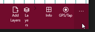
Repair layers icon label and visual.
Reported by Annick.
Some picklist seems to be missing in the struc dialog. A fold hinge should have a younging picklist associated with it.
gabriel.huot-vezina
commented May 27
Asked to Étienne and Pierre about it. They are on the case. On hold for now.
gabriel.huot-vezina
commented May 27
(edited)
select * from M_DICTIONARY WHERE CODETHEME = 'STRUCYOUNGING'
Copied from Repro Steps when changed from Bug to Feature
Reported by Annick and assesed by Pierre.
Just like in Ganfeld, a user should be able to add a mode for each entered mineral in earthmat dialog.
https://gsc-datacollection.visualstudio.com/Mockup1/_workitems/edit/356
Reported by Étienne from a course given in Calgary 2018. A paleontologist doesn't get why the fossil has been extruded from the earthmat when those two are unseperatable.
Suggestion by Étienne. Maybe fossil could be treated like the mineral, we can add records directly inside the earhtmat dialog but the edition will happen in it's own.
From Kaz
So the paleontologist would like fossils as part of a descriptor for the rock just like "textures", "fabric" in EarthMaterial - like how we had it originally in GanFeld! How we have minerals implemented in two interfaces is cause for concern in terms of complexity - we should consider re-thinking how our geologic entities are abstracted into our data model - topic for our workshop?
https://gsc-datacollection.visualstudio.com/Mockup1/_workitems/edit/373
Current setup to know if the dip or azim values are right is by coloring the boxes outlines. It was suggested that it seemed more like christmas decoration rather then actual validation problems. Suggestion would be to color the background of the boxes too. That way it'll be more in-your-face, making the user ashame of not fixing it?
https://gsc-datacollection.visualstudio.com/Mockup1/_workitems/edit/461
We got the same tpks issues, even though I fixed them, on the tablets. Sometimes it's impossible to load any tpk, other times opacity, ordering and visibility aren't kept in memory but some other times they are. I thought first that it could be related to windows version or build but it doesn't seem like it.
Tested on W10 1809 and 1803 versions of tablets.
Suggested by Annick. The light backup, which only takes a copy of the sqlite should also see the project name added to it to be consistent.
Asked by a few users that would like to go on the field and pre-entered locations before hand and take notes afterward.
https://gsc-datacollection.visualstudio.com/Mockup1/_workitems/edit/361
From @gisgorilla
When I have the Map page open (in the office) and the spinning circle and "Acquiring current location ... wait a bit ..." displays, so knowing I'm in the office I turn the GPS off, and the GPS appears to be off in the Windows 10 system tray below. But in the app the spinning circle and "Acquiriing ..." message still persists on the Map Page.
https://gsc-datacollection.visualstudio.com/Mockup1/_workitems/edit/473
From @AnnickMorin on behalf of Michel.
All dates were unordered for some reasons...
Experienced on an older version of W10 then required.
Michel Houle's tablet can't update itself to W10 version 1809 for some reasons. It's stock at 1803. The problem is that the new app needs at least 1809.
I tried all of those solutions here: https://appuals.com/windows-10-wont-install-or-download-updates/
None are working...
@AnnickMorin @gisgorilla @pbrouill
Copied from Repro Steps when changed from Bug to Feature
From an angry scientist.
This really bugged him big time.
https://gsc-datacollection.visualstudio.com/Mockup1/_workitems/edit/444
gabriel.huot-vezina
commented Dec 12, 2018
In fact it was never coded, it's more a feature then a bug. The user think the app is like an ArcMap MXD.
gabriel.huot-vezina
commented Dec 12, 2018
The latest changesets took Stephen's approach and nothing is reset anymore each time a user navigate from notes to map or settings, only navigation to existing pages occurs. Still the layer visibility must be keep after closing the app.
kaz.shimamura
commented Oct 24, 2018
I believe Steve was working on having the map page "remember" the last "view" instead of resetting? Steve any news or updates on that? By default didn't it zoom to the center of the current GPS location?
gabriel.huot-vezina
commented Oct 24, 2018
Do we keep current setup or we revert to what it used to be when we were keeping visibility in the settings? @stephen.williams @kaz.shimamura
gabriel.huot-vezina
commented Oct 24, 2018
I used to keep this as an internal setting so each time the app is opened the last saved layer visibility was set back, but for some reason it seems to have disapeared at some time.
Reported by Robert when installing the app on a new laptop.
Install app
Open, and it was set in french.
https://gsc-datacollection.visualstudio.com/Mockup1/_workitems/edit/342
gabriel.huot-vezina
commented Dec 20, 2018
can't reproduce this anywhere.
stephen.williams
commented Jun 4, 2018
On my desktop (1709 16299.431) and my tablet (1709 16299.461) with build 509 of the app, the two buttons on the bottom of the sematic zoom control (found in Earth material and Structure) are defaulting to French while all other controls are English. I have tried changing the language settings on both devices, restarting the devices, reinstalling the app but so far nothing has resolved the issue.
gabriel.huot-vezina
commented Jun 4, 2018
Stephen had the same problem with this Build - 1709 Version - 16299.461
gabriel.huot-vezina
commented Apr 3, 2018
On my side after installation on a laptop, 2 desktop, 2 phones and many tablets, never seen this problem. In the code if my memory is good, the default for the app is english, for all case that is not french, so even if the device is in japanese the app should show in english...
A declarative, efficient, and flexible JavaScript library for building user interfaces.
🖖 Vue.js is a progressive, incrementally-adoptable JavaScript framework for building UI on the web.
TypeScript is a superset of JavaScript that compiles to clean JavaScript output.
An Open Source Machine Learning Framework for Everyone
The Web framework for perfectionists with deadlines.
A PHP framework for web artisans
Bring data to life with SVG, Canvas and HTML. 📊📈🎉
JavaScript (JS) is a lightweight interpreted programming language with first-class functions.
Some thing interesting about web. New door for the world.
A server is a program made to process requests and deliver data to clients.
Machine learning is a way of modeling and interpreting data that allows a piece of software to respond intelligently.
Some thing interesting about visualization, use data art
Some thing interesting about game, make everyone happy.
We are working to build community through open source technology. NB: members must have two-factor auth.
Open source projects and samples from Microsoft.
Google ❤️ Open Source for everyone.
Alibaba Open Source for everyone
Data-Driven Documents codes.
China tencent open source team.